1 West 72 Street
Composite verdict
The Dakota (1 West 72nd Street) is a 142-year-old elevator co-op built in 1884 with an exceptionally clean HPD record — 0 open violations across all classes and an A grade with fast landlord response — and a strong crime score of 90 (A-) with zero violent incidents nearby. The building is not registered as rent-stabilized (0 of 64 units), so no tenant protections apply and rent is set by the co-op market. The dominant 311 complaint in the area is illegal parking (196 of 519 calls), and helicopter noise accounts for 65 complaints — worth noting given the Central Park proximity. No bedbug filings in the past 3 years.
Class B
Class C
past 12 months
units
past 12 mo (150m)
rent
rating
min walk
(311 complaints)
errands grade
nearby
- HPD shows 0 open violations and a fast landlord response rate — can you provide the maintenance request log for the past 12 months so I can verify how routine repairs are handled inside units?
- The building was constructed in 1884 and is 142 years old — what major infrastructure systems (boiler, plumbing, electrical, elevator) have been updated, and when were those upgrades completed?
- Rent stabilization data shows 0 of 64 units are registered as stabilized — is this unit subject to any form of rent regulation, and what governs annual rent increases or renewal terms under the co-op's subletting policy?
- 311 records show 65 helicopter noise complaints in the area over the past year — do upper-floor units or west-facing apartments experience meaningful helicopter noise, and are windows double-paned?
- Crime data shows 6 harassment incidents and 2 grand larceny incidents nearby — what building security measures are in place (doorman hours, camera coverage, package handling)?
- As a co-op, what are the board's subletting rules, approval requirements, and financial obligations (maintenance fees, assessments) that would apply to a renter, and has the building levied any special assessments in the past 5 years?
- Inspect the elevator cab, lobby finishes, and hallway infrastructure closely — at 142 years old (built 1884), look for signs of deferred maintenance such as water staining on ceilings, worn or patched plaster, and the condition of the elevator doors and mechanical room signage.
- Check window quality and street-facing sound insulation in the unit itself — the area logged 65 helicopter noise complaints and 15 general noise calls, so test windows for seal integrity and ask to visit during a time when Central Park traffic is active.
- Confirm the building's entry and package security setup in person — with 6 harassment and 2 grand larceny incidents recorded nearby, verify whether the doorman desk is staffed 24/7, whether there is camera coverage at all entry points, and how deliveries are managed.
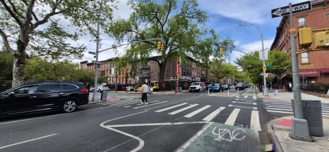
1 West 72 Street sits in Manhattan, ZIP 10023. The closest subway is 72 St (C,B) (2-minute walk), served by the 1, 2, 3, B, and C lines. Within an 800-meter walk you'll find 79 restaurants, 43 cafes, 16 groceries, and 6 pharmacies — a walkable-errands grade of A. Nearby public schools include J.H.S. M044 William J. O'Shea (grades 5 to 8), a 6-minute walk. Noise activity over the past 12 months is low noise activity — 14 noise complaints filed via 311, mostly street and sidewalk noise. NYPD CompStat data places this precinct at a 90/100 safety score.
- Illegal Parking: 196
- Noise - Helicopter: 65
- Traffic Signal Condition: 25
- Sanitation Worker or Vehicle Complaint: 24
- Noise: 15
- Jun 30, 2023 "VIOLATION ISSUED-FAILURE TO FILE 2021 EXTERNAL LOW PRESSURE INSPECTION"
- Jun 30, 2023 "VIOLATION ISSUED-FAILURE TO FILE 2021 EXTERNAL LOW PRESSURE INSPECTION"
- Jun 30, 2023 "VIOLATION ISSUED-FAILURE TO FILE 2021 EXTERNAL LOW PRESSURE INSPECTION"
- 15 WEST 72ND STREET CORP.
- F. I. LANDSCAPING CORP.
- INTERIORS BY GLEN, LLC
- J.H.S. M044 William J. O'Shea
- The Anderson School
- P.S. 087 William Sherman
- J.H.S. M044 William J. O'Shea
- M.S. M245 The Computer School
- M.S. M247 Dual Language Middle School
- J.H.S. M044 William J. O'Shea
- M.S. M245 The Computer School
- M.S. M247 Dual Language Middle School
- 72 St
- 72 St
- 81 St-Museum of Natural History
Latest news from Weverit.
Tenant guides, law changes, and neighborhood reports — written in plain English, sourced from the same public records that power Weverit building reports.
The Court Ruling That Changed Section 8 in New York
On March 5, a New York appeals court ruled that the state's source-of-income discrimination protection is unconstitutional on its face insofar as it compels landlord participation in Section 8. The Attorney General will appeal. What the ruling does, what it doesn't do, and what voucher holders should know in the meantime.
Read article →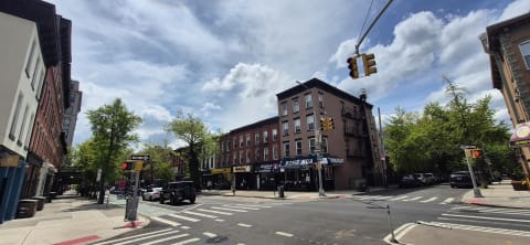
The Forums Starting May 20
The first of three new forums between NYCHA residents and senior city officials is scheduled for May 20 in the Bronx. The format, the registration, and the conditions data that form the practical backdrop for what is being discussed.
Read article →
The Report Due July 6
The Rental Ripoff Hearings ended April 7. Most New Yorkers do not know what comes next. Within 90 days, four city agencies must submit a joint report with reform recommendations and a measurable target for violation correction speed. The deadline is July 6.
Read article →
Eleven Months After the Broker Fee Ban
The FARE Act took effect June 11, 2025. Eleven months in, more than 1,125 broker-fee complaints have been filed with the city. The law worked. The market is also working around it.
Read article →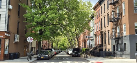
The Bill That Came Back
The Community Opportunity to Purchase Act was passed in December, vetoed in January, and pronounced finished a week later. Last Wednesday, its sponsor confirmed a revised version is coming back within thirty days. What COPA actually changes for tenants — beyond the headlines about "government overreach.
Read article →
A Rent Freeze Is Officially on the Table
The Rent Guidelines Board cast its preliminary vote Thursday at LaGuardia Community College. For the first time since 2016, zero is mathematically inside the range of possible outcomes for stabilized rents. The June vote will choose the number inside it.
Read article →Recent building reports from Weverit.
The most recently generated reports from real NYC addresses — independent due-diligence on buildings tenants are actually checking.
2007 Cortelyou Road
Free public-records report for 2007 Cortelyou Road: violations, complaints, rent stabilization, transit, schools.
Read report →400 Manhattan Avenue
Free public-records report for 400 Manhattan Avenue: violations, complaints, rent stabilization, transit, schools.
Read report →499 East 8 Street
Free public-records report for 499 East 8 Street: violations, complaints, rent stabilization, transit, schools.
Read report →2914 Gerritsen Avenue
Free public-records report for 2914 Gerritsen Avenue: violations, complaints, rent stabilization, transit, schools.
Read report →34 East 34 Street
Free public-records report for 34 East 34 Street: violations, complaints, rent stabilization, transit, schools.
Read report →19 Dutch Street
Free public-records report for 19 Dutch Street: violations, complaints, rent stabilization, transit, schools.
Read report →