1833 East 12th Street
Top insights
- 3 open hazardous (Class C) violations
- Built in 1959 (city records)
- Rent-stabilized: 81 of 81 units
About this building
City records list 1959 as the year built — newer than 88% of the 109 buildings we cover in ZIP 11229. The building’s floor space is 3.5 times the size of its lot: 68,530 sq ft of building on a 19,390 sq ft lot.
Comparisons with neighboring buildings, as of October 13, 2026.
Class B
Class C
12 months to Aug 2026
rent-stabilized with
DHCR (most recent year)
units (PLUTO)
12 months through June 2026
rent
min walk
(311 complaints)
errands grade
nearby
1833 East 12th Street
Open in Google Street View ↗
- City records show 5 open HPD violations, 3 immediately hazardous (Class C) at this building. Ask which are still unresolved in the unit and the landlord’s timeline to clear them.
- The oldest open violation on record dates to 2020 — why has it stayed open this long, and is it in or near this unit?
- DHCR’s most recent registration lists 81 rent-stabilized units here. Ask whether this specific unit is one of them, and ask the landlord for its legal regulated rent and lease history.
- City Buildings Department records show an open life-safety condition (e.g. unsafe building / hazardous facade) — what is it, and has it actually been resolved, not just re-filed?
- Confirm the condition behind the most recent open violation was actually repaired, not just marked closed: Abate the infestation consisting of roaches in the entire apartment.
- Confirm in person that the immediately-hazardous (Class C) conditions — typically heat, hot water, leaks, mold or pests — are genuinely fixed, not just marked closed.
1833 East 12th Street sits in Brooklyn, ZIP 11229. The closest subway is Kings Hwy (B,Q) (6-minute walk), served by the B and Q lines.
Building Condition
Oldest open violation: November 2020 · Most recent: June 2026. HPD marks a violation open until it is certified as corrected, so an old date can mean an unresolved condition or a repair that was never certified.
- 2026-06-14 "§ 27-2021 ADM CODE PROVIDE SUFFICIENT, PROPER AND SEPARATE METAL RECEPTACLES FOR THE DEPOSIT OF GARBAGE, RUBBISH AND OTH…"
- 2025-07-31 "HMC ADM CODE: § 27-2017.4 ABATE THE INFESTATION CONSISTING OF ROACHES IN THE ENTIRE APARTMENT LOCATED AT APT 3L, 3rd STO…"
- 2021-09-20 "§ 27-2017.3 HMC: TRACE AND REPAIR THE SOURCE AND ABATE THE VISIBLE MOLD CONDITION... CEILING AND SOUTH WALL APPROX 18 SQ…"
- 2020-11-13 "§ 27-2056.4 ADM CODE- CORRECT FAILURE TO NOTIFY OCCUPANTS AND/OR TO INVESTIGATE LEAD-BASED PAINT HAZARDS."
- 2020-09-14 "§ 27-2056.4(H) AND 27-2056.17 ADM CODE -CORRECT FAILURE TO PROVIDE TO THE DEPARTMENT WITHIN 45 DAYS OF DEMAND ALL RECORD…"
- 2025-07-31
- Class C · 3 open · penalty 45 · (15/ea)
- Class B · 2 open · penalty 10 · (5/ea)
- 2026-06-11 · Apt BLDG · NON EMERGENCY · UNSANITARY CONDITION
- 2026-05-30 · Apt BLDG · EMERGENCY · HEAT/HOT WATER
- 2026-03-18 · Apt BLDG · EMERGENCY · HEAT/HOT WATER
- 2025-04-11
- 2021-01-11 "CYCLE 9B UNSAFE REPORT FILED"
- 2020-09-02 "FAILURE TO CERTIFY CORRECTION ON IMMEDIATELY HAZARDOUS (CLASS 1) ECB VIOLATION"
- 2019-09-17
3 lead-paint hazards cited and later remediated (most recent 2021); no open hazards on record. Remediation addresses the cited conditions, not necessarily every painted surface.
Under NYC Local Law 1 (Admin Code §27-2056.5), lead paint is presumed present in common areas and in apartments where a child under 6 resides, in multiple dwellings built before 1960 (this building: built 1959). The presumption stands unless the owner obtained a lead-free or lead-safe exemption from HPD. Those exemption records aren’t published as open data, so we can’t confirm one either way.
Also on record: 2 procedural §27-2056 violations (failure to file required lead paperwork, most recent 2020) — a records failure, not evidence of a lead hazard.
The Building
Neighborhood & Environment
~1 block 300m
~2-3 blocks
- PETIT LARCENY: 211
- HARRASSMENT 2: 25
- GRAND LARCENY: 21
- ASSAULT 3 & RELATED OFFENSES: 21
- CRIMINAL TRESPASS: 17
- Blocked Driveway: 130
- Noise - Residential: 92
- HEAT/HOT WATER: 79
- Illegal Parking: 46
- UNSANITARY CONDITION: 22
- 2155 CONEY ISLAND AVE
- 2163 CONEY ISLAND AVENUE
- 2131 CONEY ISLAND AVE
- P.S. 255 Barbara Reing School
- P.S. 153 Homecrest
- P.S. 238 Anne Sullivan
- J.H.S. 234 Arthur W. Cunningham
- P.S. 238 Anne Sullivan
Levels add up to 6 because a school serving K-8 is listed under both Elementary and Middle. 5 distinct schools are within range.
- Kings Hwy
- Avenue U
- Grade A
- Grade A
- Grade A
- Grade A
- Grade A
- Grade A
- Grade A
- Grade A
- Sgt. Joyce Kilmer Square
- Becec Inc
- Bet Yaakov Ateret Torah
- P.s. 255 Barbara Reing School
- Kelly Park Playground
- Bnos Esther Malka
Internet providers serving this area
Internet providers available in this area — including fiber:
- Optimum Cable Fiber Up to 8,000 Mbps down · 8,000 Mbps up
- Verizon Fiber Up to 2,300 Mbps down · 2,300 Mbps up
How to check internet providers before signing an NYC lease →
Source: FCC Broadband Data Collection (NY, rev. May 2026). Wired broadband only — cable + fiber. DSL, satellite, and fixed-wireless not included. Block-level data; actual availability may vary by building.
Market & Availability
Latest news from Weverit.
Tenant guides, law changes, and neighborhood reports — written in plain English, sourced from the same public records that power Weverit building reports.
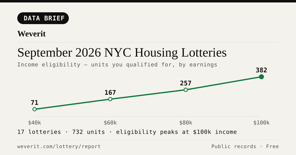
September 2026 NYC Housing Lotteries: Who Qualifies
28 lotteries, 965 affordable units — who qualifies by income, plus rents, AMI bands and application windows, from public records.
Read article →
Your Housing Connect Log Number Came Up. Here's What to Check Before You Sign.
A Housing Connect listing tells you the rent and the apartment size. It does not tell you how the building is run. Seven public records to check before you sign — and what a clean record does not mean.
Read article →
NYC's Smallest Apartment Buildings Have Four Times More Dangerous Violations Per Apartment Than Its Largest
We measured open HPD violations per apartment across NYC buildings. Buildings with six units or fewer carry four times the immediately-hazardous violations per apartment that buildings of 38+ units do — and they are the least likely to draw attention.
Read article →
Pets in your NYC apartment: the no-pet clause, the waiver rule, and what your landlord can actually enforce
NYC's Pet Law gives tenants who openly keep a pet for 3 months legal protection against no-pet clauses. Here's exactly how it works.
Read article →
How to find out who owns your NYC apartment building
Most NYC buildings are owned through LLCs. Here's how to trace the owner through ACRIS, HPD registration, and DOF records — step by step.
Read article →
How to check a NYC building's complaint history — and what it actually means
Complaints and violations are not the same thing. Here's how to read HPD and DOB records — and what the patterns actually tell you about a building.
Read article →
Certificate of Occupancy in NYC: what it is and why it matters before you sign
A C of O defines how a building can legally be used and how many units are permitted. Here's what to check — and what missing or mismatched records mean for tenants.
Read article →Recent building reports from Weverit.
The most recently generated reports from real NYC addresses — independent due-diligence on buildings tenants are actually checking.
390 Broadway
Free public-records report for 390 Broadway: violations, complaints, rent stabilization, transit, schools.
Read report →720 Amsterdam Avenue
Free public-records report for 720 Amsterdam Avenue: violations, complaints, rent stabilization, transit, schools.
Read report →2514 Cortelyou Road
Free public-records report for 2514 Cortelyou Road: violations, complaints, rent stabilization, transit, schools.
Read report →38-18 32nd Street
Free public-records report for 38-18 32nd Street: violations, complaints, rent stabilization, transit, schools.
Read report →41-04 27th Street
Free public-records report for 41-04 27th Street: violations, complaints, rent stabilization, transit, schools.
Read report →370 Central Avenue
Free public-records report for 370 Central Avenue: violations, complaints, rent stabilization, transit, schools.
Read report →Check another building
Pull the same public-records report for any NYC address — free, no signup.
Never miss an affordable apartment
Weverit's lottery digest tracks new NYC Housing Connect lotteries and no-lottery re-rentals — one curated email.
Get the lottery digest →