48 Broome Street
Class B
Class C
12 months to Jun 2026
rent-stabilized with
DHCR (most recent year)
units (PLUTO)
12 months through March 2026
rent
min walk
(311 complaints)
errands grade
nearby
Top insights
- No open HPD violations — cleaner than 61% of buildings in this ZIP
- Built before 1939 (city records: 1928) — likely subject to NYC lead-paint rules
About this building
The building’s floor space is 2.3 times the size of its lot: 4,500 sq ft of building on a 2,000 sq ft lot.
Comparisons with neighboring buildings, as of November 2, 2026.
48 Broome Street
Open in Google Street View ↗
- City records show no open HPD violations under HPD building ID 807873 — ask what was most recently repaired and how maintenance requests are handled, since a clean record isn’t a guarantee of upkeep.
- We found no DHCR rent-stabilization unit count for this building. That is not the same as the building being market-rate — a registration can be on file with no unit figure, or not have been filed at all. Ask the landlord directly whether the unit is rent-stabilized, and request your own rent history from DHCR.
48 Broome Street sits in Brooklyn, ZIP 11222. The closest subway is Nassau Av (G) (7-minute walk), served by the G line.
Building Condition
- 2015-10-01 "VIOLATION ISSUED FOR FAILURE TO FILE ANNUAL BOILER 2014 INSPECTION REPORT"
No HPD lead-paint violations are on record for this building. That means no complaint or inspection was filed — not that the building is lead-free.
Built 1928. Under NYC Local Law 1 (Admin Code §27-2056.5), lead paint is presumed present in common areas and in apartments where a child under 6 resides, in multiple dwellings built before 1960. The presumption stands unless the owner obtained a lead-free or lead-safe exemption from HPD. Those exemption records aren’t published as open data, so we can’t confirm one either way.
The Building
Neighborhood & Environment
~1 block 300m
~2-3 blocks
- PETIT LARCENY: 37
- GRAND LARCENY: 22
- HARRASSMENT 2: 17
- CRIMINAL MISCHIEF & RELATED OF: 15
- ASSAULT 3 & RELATED OFFENSES: 12
- Illegal Parking: 132
- Noise - Residential: 32
- Blocked Driveway: 21
- Street Condition: 21
- Water System: 18
- 162 DRIGGS AVE
- 160 DRIGGS AVE
- 109 ENGERT AVE
- P.S. 110 The Monitor
- Citizens of the World Charter School 1 Williamsbur
- P.S. 034 Oliver H. Perry
- John Ericsson Middle School 126
- Northside Charter High School
- Nassau Av
- Grade A
- Grade A
- Grade A
- Grade A
- Grade A
- Grade A
- Grade A
- Grade A
- Lentol Garden
- Ericsson Playground
- St Stanislaus Kostka Catholic Acad
- John Ericsson Middle School 126
- Ess Community Projects Inc
- Northside Charter High School
Internet providers serving this area
Internet providers available in this area:
- Spectrum Cable Up to 1,000 Mbps down · 1,000 Mbps up
How to check internet providers before signing an NYC lease →
Source: FCC Broadband Data Collection (NY, rev. May 2026). Wired broadband only — cable + fiber. DSL, satellite, and fixed-wireless not included. Block-level data; actual availability may vary by building.
Market & Availability
Latest news from Weverit.
Tenant guides, law changes, and neighborhood reports — written in plain English, sourced from the same public records that power Weverit building reports.
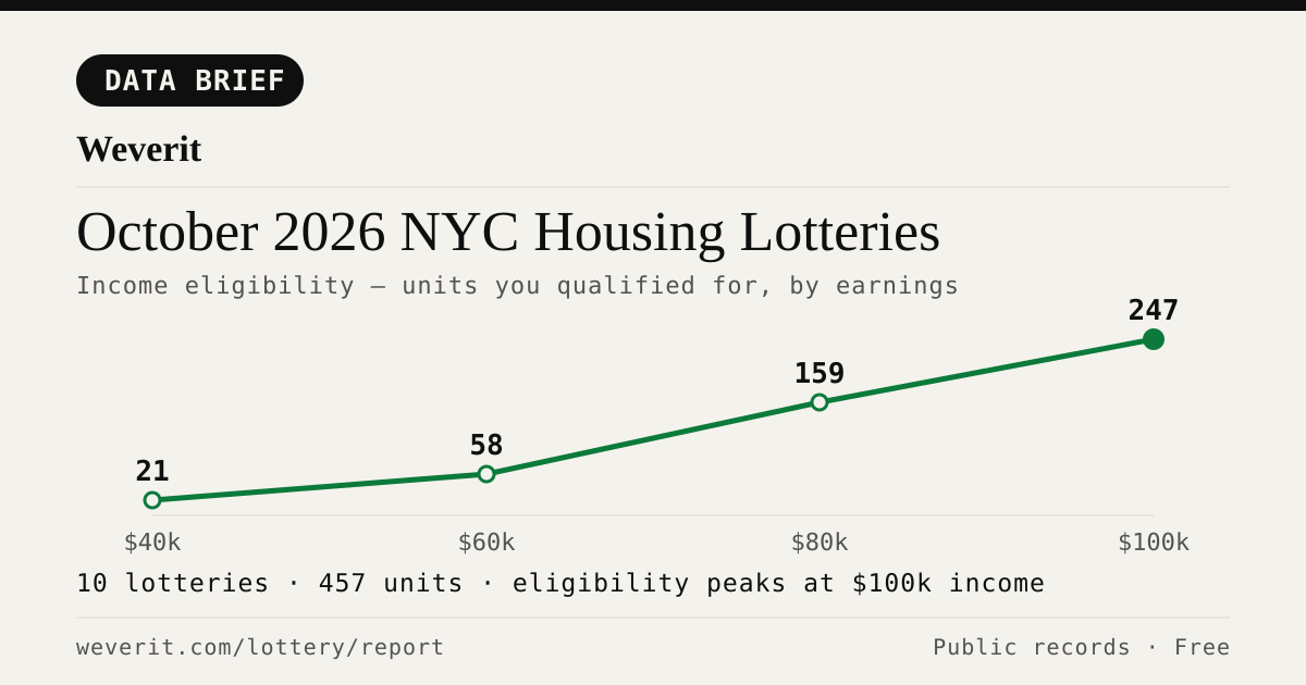
October 2026 NYC Housing Lotteries: Who Qualifies
10 lotteries, 457 affordable units — who qualifies by income, plus rents, AMI bands and application windows, from public records.
Read article →
How Long Does NYC Housing Connect Take? From Application to Keys
The official guide says interviews come two to ten months after a deadline. A 2026 case study of one Bronx building shows what can happen after that, and why most applicants drop out.
Read article →
Selected in NYC Housing Connect? What Happens Next and the Documents You Need
Your Housing Connect log number came up. Here is what the eligibility review looks like, which documents to gather, and the response deadlines that knock out most applicants.
Read article →
NYC Housing Connect Login Problems: Recover Your Account
Locked out of NYC Housing Connect? Learn how to reset your password, recover your email access, avoid duplicate applications, and contact HPD.
Read article →
Your Housing Connect Log Number Came Up. Here's What to Check Before You Sign.
A Housing Connect listing tells you the rent and the apartment size. It does not tell you how the building is run. Seven public records to check before you sign — and what a clean record does not mean.
Read article →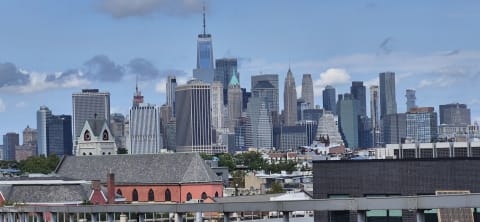
NYC's Smallest Apartment Buildings Have Four Times More Dangerous Violations Per Apartment Than Its Largest
We measured open HPD violations per apartment across NYC buildings. Buildings with six units or fewer carry four times the immediately-hazardous violations per apartment that buildings of 38+ units do — and they are the least likely to draw attention.
Read article →
Pets in your NYC apartment: the no-pet clause, the three-month rule, and what your landlord can actually enforce
NYC's three-month pet rule may protect tenants in some buildings. Learn about landlord notice, court deadlines, exceptions, and how to document your case.
Read article →Recent building reports from Weverit.
The most recently generated reports from real NYC addresses — independent due-diligence on buildings tenants are actually checking.
200 Court Street
Free public-records report for 200 Court Street: violations, complaints, rent stabilization, transit, schools.
Read report →303 East 60th Street
Free public-records report for 303 East 60th Street: violations, complaints, rent stabilization, transit, schools.
Read report →146 West 76th Street
Free public-records report for 146 West 76th Street: violations, complaints, rent stabilization, transit, schools.
Read report →321 East 88th Street
Free public-records report for 321 East 88th Street: violations, complaints, rent stabilization, transit, schools.
Read report →1777 Topping Avenue
Free public-records report for 1777 Topping Avenue: violations, complaints, rent stabilization, transit, schools.
Read report →347 Broadway
Free public-records report for 347 Broadway: violations, complaints, rent stabilization, transit, schools.
Read report →Check another building
Pull the same public-records report for any NYC address — free, no signup.
Never miss an affordable apartment
Weverit's lottery digest tracks new NYC Housing Connect lotteries and no-lottery re-rentals — one curated email.
Get the lottery digest →